Remutaka Road Action Group
A new modern highway connecting the Wairarapa with Wellington and the World
Alternate Route Options
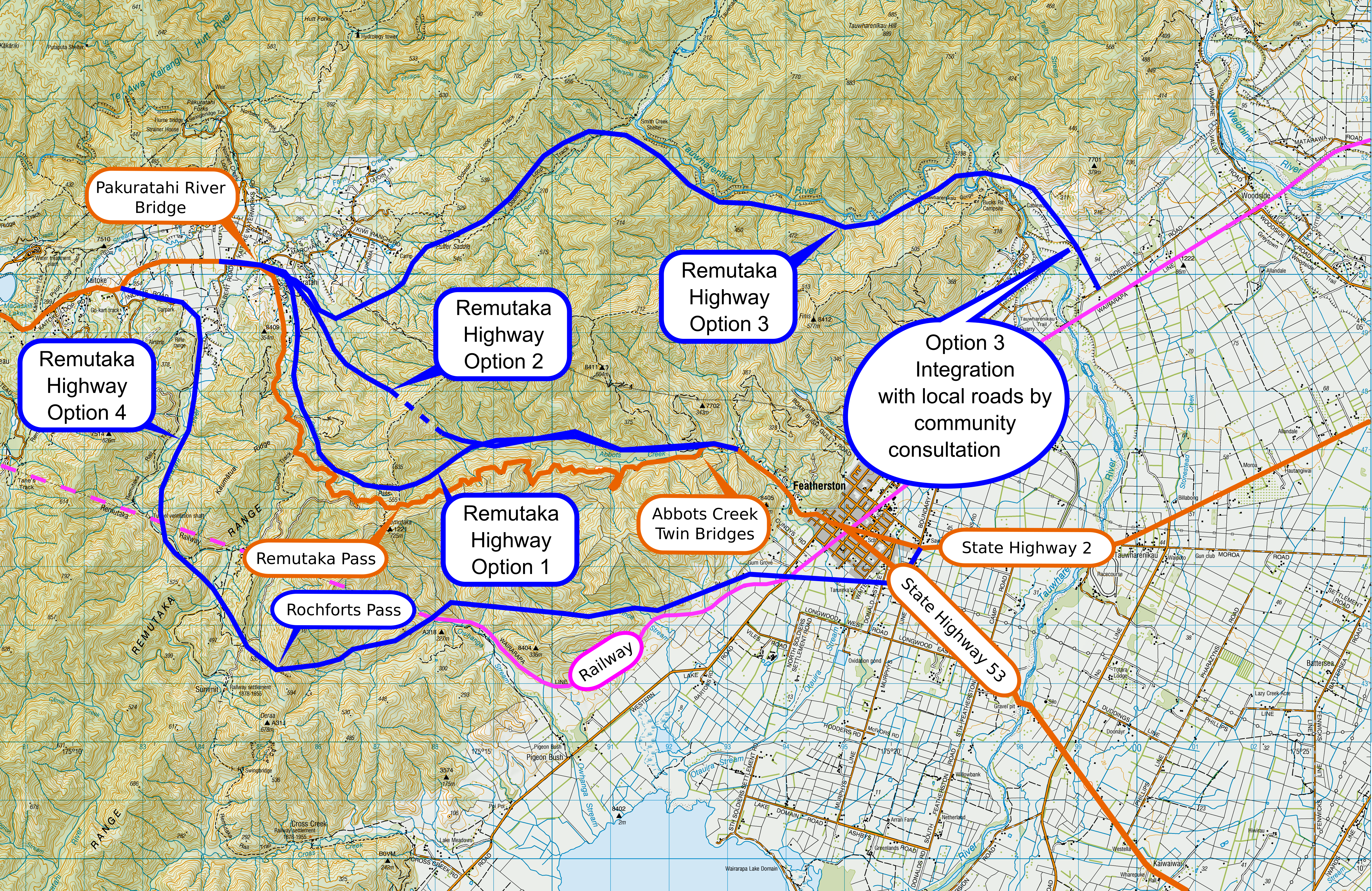
Currently there are 4 alternative routes identified as shown in the map below.

| Current Route | Alt Route 1 | Alt Route 2 | Alt Route 3 | Alt Route 4 | |
|---|---|---|---|---|---|
| Length | 14.6 Km | 11.4 Km | 9.6 Km | 18 Km | 20 Km |
| Summit Elevation | 555 m | 400 m | 340 m | 400 m | 420m |
| Summit Type | Contour following | Open Cutting | 1.3 Km tunnel | Open Cutting | Open Cutting |
| Peak Gradient | 31.4% | < 5% | < 5% | < 5% | <5% |
| Est Travel Time Saving | n/a | 11.6 mins | 13 mins | n/a | 9.6 mins |
| Est Construction Cost | n/a | $1.23B | $1.4B | $1.05B | $1.25B |
All route options have significantly better alignment and are flatter than the current route. But in order to achieve that, the route will either require a tunnel or an open cut-through which costs much less than tunneling.
Summit cut-throughs are preferable to tunnels. Highway tunnels are often closed for maintenance several nights per month. Some vehicles such as those carrying hazardous substances are not allowed to use tunnels. Also, tunnels create problems for emergency services. However tunnels are the only practical option should a cutting result in excessive earthworks as would be the case in route option 2.
3 of the routes have the same Kaitoke start/end point which is a proposed roundabout at the SH2, Gilbert Rd and Waterworks Rd intersections. Routes 1 and 2 have the same Wairarapa start/end point which is the Cave’s Bridge.
The route 3 start/end point on the Wairarapa side is adjacent to the Tauwharenikau River. This route would result in highway traffic bypassing Featherston township and no longer crossing the railway line there. Connection to the existing SH2 would be made between Featherston and Greytown and will involve a bridge over the railway line.
Route 4 is alongside the Remutaka Cycle Trail on the Kaitoke side.
© Remutaka Road Action Group